
Well, this week we designed maps focused on three coastal counties in Mississippi (Hancock, Harrison, Jackson). The series of maps begin by showing the elevation, bathymetry and hydrography of the study area which will show low lying areas prone to flooding by hurricane induced storm surge. The second map shows the type of landcover that was most affected with the percentages of each landcover area accompanying the map in a graph. As expected the most flood prone area was the coastal wetlands.
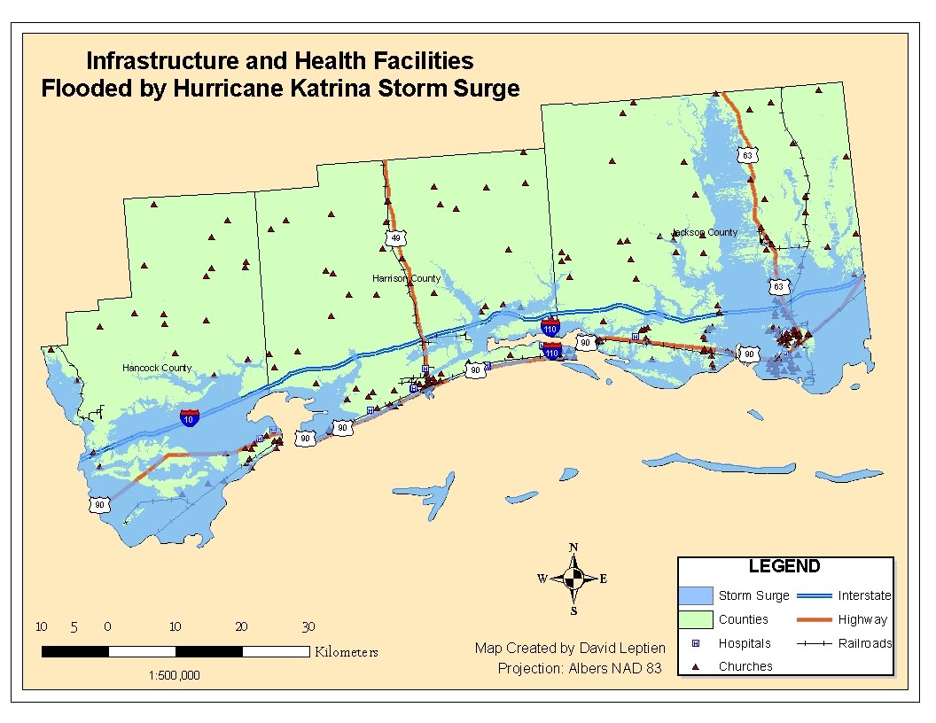
The next map shown outlines certain infrastructure (major roads, railroads, hospitals and churches) that were damaged from the storm surge. The toughest part involved with this map is the decision as to where funds should be allocated first, roads or hospitals. Hospitals would need assistance due to being full of patients, where as roads are needed to transport new patients and supplies to the hospitals. I guess those decisions come from experience.
Overall this was a very good exercise and I really had no issues with the technical aspects of designing the maps with the exception of labeling features. When features are labeled, the labels are placed by arcmap, sometimes in inconvenient and hard to read locations. I annotized the labels which helped me to relocate all the labels in a particular layer but not to edit each individual labels location. I will continue to search for a way to have more control over the postioning of feature labels.
No comments:
Post a Comment